
Earth (254)
Planet Earth, the only speck in the Universe confirmed by humans to have evolved higher forms of life. Watch NASA's phenomenal movie summarizing Life on Earth.
Learn about using your forest as a carbon sink

KNOXVILLE — The next installment of Conservation on Tap is set for 7 p.m. Jan. 8 at Albright Grove Brewing Company, 2924 Sutherland Ave., Knoxville.
Join forester Sean Bowers to learn about the Family Forest Carbon Program, a partnership between the American Forest Foundation and The Nature Conservancy. The program allows owners of small tracts of forest access to carbon markets, empowering them to improve the health and wellbeing of their forests and help tackle climate change.
All proceeds from Conservation on Tap benefit Discover Life in America.
Feds to restart “technical and design work” for Foothills Parkway extension
Written by Thomas Fraser
Conservation groups have cautioned against the zombie roadway between Wears Valley and Gatlinburg; EIS-level study uncertain
This story will be updated.
Concerns raised by the public over the decades range from impacts on domestic water supplies and endangered or threatened species to the fact the roadway might be a catalyst for excessive tourism infrastructure in Townsend and Wears Valley.
NOAA’s Teek and Tom bring fun and free science to classrooms and homes

It’s all about the ocean-weather-climate connection!
Join intrepid student explorer Teek from planet Queloz and National Oceanic and Atmospheric Administration (NOAA) climate scientist Tom Di Liberto as they explore planet Earth’s weather and climate. This five-part science series covers a range of scientific topics, including how the ocean influences weather and climate on Earth, and the technologies scientists use to gather information about our planet and its changing climate.
Each episode is supplemented by two lesson plans designed for students in the fourth through sixth grades — all of which are compiled in a single Educator’s Guide. Each lesson allows students to explore and investigate NOAA data, visualizations and content, allowing them to build knowledge of and skills associated with important Earth science concepts.
An understanding of how the Earth works as a system and how humans interact with the Earth is important for all inhabitants of our planet. Teek and Tom are a fun and engaging way to grow that understanding!
Teek and Tom: Educator’s Guide
The Teek and Tom Educator’s Guide includes 10 lesson plans — two supplementing each episode. The lessons allow students to build knowledge of and skills associated with important Earth science concepts. Through the exploration and investigation of NOAA data, visualizations, and content, the lessons support the videos in telling a cohesive story of key Earth systems, and how those systems impact each other.
Each lesson is aligned to the Next Generation Science Standards (NGSS), national standards for math, national standards for English and language arts, and the College, Career, and Civic Life (C3) Framework for Social Studies State Standards. These standards reinforce the interdisciplinary nature of ocean, weather and climate studies, and support the teaching of these topics. The lessons engage students in content that is locally relevant; and use the 5E model (Engage, Explore, Explain, Elaborate, Evaluate) to provide a structure for students to connect science ideas with their own experiences, and apply their learning to new contexts.
To access this high-caliber, free science lesson, download the educator’s guide.
Helene: Storm left devastation from Mountains to Sea
Written by Mark Barrett Water rose an estimated 15-18 feet on this side channel of North Fork of the Catawba River near Marion, N.C. Photos by Mark Barrett
Impromptu backcountry hike reveals extent of remote storm wreckage in WNC
Mark Barrett is an Asheville-based journalist. He reported for the New York Times at the height of Tropical Storm Helene.
MARION — I had a lot of chores to do Saturday but went hiking instead. I had read that the Mountains-to-Sea Trail was open from Woodlawn, N.C., a few miles north of Marion, east to the North Fork of the Catawba River so I decided to see what was left of the pedestrian bridge across the river after Helene.
I took a logging road part of the way there and before I reached the river I managed to make a wrong turn. Once I realized my mistake I decided to go cross country instead of retracing my steps since that would be shorter.
I walked into one of the scenes folks living in Western North Carolina are familiar with: Helene blew down two out of every three trees. Places like this make hiking a contact sport, and a slow and laborious one at that. Still, it was interesting to see.

After maybe half a mile of walking on, under and over downed trees, I made it into open woods and not far after that, to the spot where the bridge once stood. The only things visible were the abutments on either end and the pier, which had washed 50 to 100 yards downstream. Photos of the pier taken before Helene show it sitting on dry ground with an area behind it where it looks like water washed through during a flood. On my way back toward my car, I saw the main part of the bridge on the opposite side of the river a third of a mile or so downstream.
Park service opens trail to forever in Great Smokies
Written by Dave Barak A trail crew takes a breather after laboring on the Ramsey Cascades Trail in Great Smoky Mountains National Park. Crew members and park officials formally opened the rehabilitated trail this week after three years of work. National Park Service
Radically enhanced Ramsey Cascades Trail leads to national park’s highest waterfall
Dave Barak is a public affairs specialist with the National Park Service.
GATLINBURG — In collaboration with Friends of the Smokies, the National Park Service (NPS) completed a three-year restoration of the Ramsey Cascades Trail in Great Smoky Mountains National Park. Located in the Greenbrier area, this popular trail ascends through beautiful hardwood forests to the 105-foot Ramsey Cascades, the tallest waterfall in the park. The trail is now open seven days a week following an extensive reconstruction and rehabilitation.
The NPS and Friends of the Smokies celebrated the milestone at the Ramsey Cascades trailhead. Following remarks and a ribbon-cutting, several participants hiked the newly restored trail together.
Improvements to the Ramsey Cascades Trail include:
Throughout this rehabilitation, the NPS restored Ramsey Cascades — with the original trail design in mind — in a way that blends in with the natural landscape. Trail crew members used natural materials and hand tools and transported most tools and equipment by hand or pack mule. A helicopter delivered several loads to five drop sites that the mule team could not access. The trail crew used 1,200 black locust logs and 760,000 pounds of rock crush for fill for this rehabilitation.
 Crews had to carry many materials and tools to the site by hand or mule. National Park Service
“Trails Forever is an excellent example of the collaborative partnership between Great Smoky Mountains National Park and Friends of the Smokies,” said Boone Vandzura, Acting Deputy Superintendent. “Together we’ve preserved and rehabilitated trails that enhance the recreational experience of millions of visitors.”
In war-torn Ukraine, nature refills reservoir destroyed by Russia
Written by Ruchi Kumar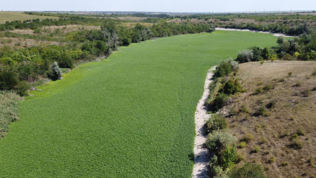 A range of vegetation has moved into the former Kakhovka reservoir in Ukraine. Russian occupying forces destroyed the dam along the Dnieper River in June 2023. Photos by Serhiiy Skoryk
Russia’s bombing of Kakhovka Dam in 2023 killed hundreds of people and tens of thousands of animals, but it also provided a potential ecological reset.
This story was originally published by The Revelator.
KYIV — In the early hours of June 6, 2023, two large explosions reverberated across cities and small towns located on the banks of the Dnieper River in southern Ukraine. The Russian military had reportedly set off multiple bombs, destroying the three-kilometer-long Kakhovka Dam and draining its massive reservoir into nearby settlements.
Water from the dam flooded the plains, killing hundreds of civilians and countless livestock, destroying farms, and displacing the residents of more than 37,000 homes.
The bombing made headlines around the world. It’s the long-term impact of the attack on the local biodiversity, however, that has scientists and experts concerned. In the weeks following the explosion, researchers from Ukrainian ministries and independent organizations carried out several assessments as best they could to the backdrop of the war.
They found that the attack had flooded about 60,000 hectares (230 square miles) of forest in at least four national parks, threatening an estimated population of 20,000 animals and 10,000 birds.
 Serhiiy Skoryk, a national park director, is seen with landmines that are typical of those that have literally flooded the conflict zone during the Russian occupation of parts of Ukraine. These mines and other hazards complicate efforts to gauge the impact of the Russian invasion on Ukraine’s unique natural environment.
- russian ukraine conflict
- russian ukraine war
- ukraine war
- ukraine reservoir
- war and nature
- war effects on environment
- war pollution ukraine
- war affects on environment
- the revelator
- kakhovka dam
- dnieper river
- rewilding
- nature reclaiming reservoirs
- examples of nature reclaiming reservoirs
- legacy landmines
- landmine dangers
A long, sad tale of when coal ash filled a valley so low
Written by Ray Zimmerman In the early morning hours of Dec. 22, 2008, the earthen wall of a containment pond at Tennessee’s Kingston Fossil Plant gave way. The breach released 1.3 million cubic meters (1.7 cubic yards) of sludge, infiltrating a nearby river and damaging dozens of homes. NASA Earth Observatory
Journalist’s book offers deep sweep of 2008 coal-ash disaster at TVA’s Kingston coal plant
CHATTANOOGA — Jared Sullivan’s book, Valley So Low, is “A courtroom drama about the victims of one of the largest environmental disasters in US history — and the country lawyer who challenged the notion that, in America, justice can be bought.” Those words from the publisher’s dust jacket sum up the story, but the pathos of workers, certain that they got sick on the job, and the lawyer’s struggle against a well-funded corporate defense, is in the details.
Most residents of the Tennessee Valley remember the 2008 disaster when a wall of a coal ash slurry rushed out of the Kingston Steam Plant, flooding the Emory River and inundating 300 acres of the surrounding countryside.
Sullivan offered insight into the story to an audience in Chattanooga in October. When workers fell ill after the cleanup, local personal injury lawyer Jim Scott challenged Jacob’s Engineering, a private company the Tennessee Valley Authority contracted to manage the cleanup. Scott was the only lawyer willing to take their case, according to Sullivan.
- jared sullivan
- kingston coal ash spill
- kingston coal ash spill book
- 2008 coal ash disaster
- coal ash cleanup
- coal ash spill
- coal ash contamination
- coal fly ash slurry
- valley so low
- valley so low review
- ray zimmerman
- chattanooga nature events
- tennessee valley authority
- is coal ash storage unsafe
- coal ash book
- environmental journalist
- environmental journalism
Helene: A month after epic flooding, Smokies still reeling from storm effects
Written by Holly Kays The Hiram Caldwell House looks out over a road rendered impassable following major flooding on Rough Fork Creek. Cataloochee Valley is closed until further notice. National Park Service
Damage to park infrastructure widespread on North Carolina side of Great Smoky Mountains National Park
Holly Kays is the lead writer for Smokies Life.
GATLINBURG — As Hurricane Helene gathered strength in the southern Gulf of Mexico, it seemed likely Great Smoky Mountains National Park would take a direct hit. The storm was a category 4 before slamming Florida’s Gulf Coast; then it headed north toward the Smokies.
But its course shifted east. Helene and its predecessor storm dropped unfathomable amounts of rain across Southern Appalachia — many places received well over a dozen inches in a matter of days, with some locations recording two dozen or more. The storm’s severity was unprecedented in the region, causing flash floods and landslides that have so far claimed at least 95 lives in North Carolina alone. Asheville, where extreme flooding destroyed entire neighborhoods and decimated the water system, logged more than 14 inches between September 24 and September 28.
Most of the park fell far enough west of Helene’s path to escape with only minor flooding, but its extreme eastern region — Cataloochee, Balsam Mountain, Big Creek — was inundated. Record-setting rains tore out trails and roads and damaged historic buildings, leading the park to close these areas until further notice.
 Cataloochee Valley is closed until further notice after flooding from Rough Creek Fork rendered Upper Cataloochee Valley Road impassable. National Park Service
 The CSX rail line through the Nolichucky River Gorge near Erwin, Tennessee was one of many transportation and vital commerce links destroyed by epic river flooding spawned by Tropical Storm Helene Sept. 26-27, 2024. Jonathan Mitchell for Hellbender Press
ORNL Climate Change Institute: Weirdly warm water that spawned and fed Hurricane Helene was 500 times more likely due to climate change
OAK RIDGE — Hellbender Press spoke with Oak Ridge National Laboratory Climate Change Science Institute Director Peter Thornton about whether Hurricane Helene and its subsequent and disastrous impact on the Southern Appalachians was made worse by climate change. Citing an increasing scientific ability to link climate change to specific weather events, he said in a very matter-of-fact manner that yes, Helene was fueled by the symptoms and consequences of global warming caused by human emissions of carbon and other pollutants.
Thornton cited a World Weather Attribution report as a main source for his data and commentary, and summarized its research on Helene for Hellbender Press. Here is the interview, edited for clarity and brevity:
“I am the director of the Climate Change ScienceInstitute at Oak Ridge National Laboratory. I am a corporate fellow researchstaff at the laboratory in the area of earth system modeling and coupled carbon-cycle climatefeedbacks at the global scale all the way down to local scales.”
HP: The effects of Hurricane Helene were worsened by preceding rain events, correct?
“The event as it played out along the sort of the eastern flankof the Southern Appalachians was influenced strongly by precipitation that came beforethe storm even made landfall. There was what’s referred to as a stalled cold front, which was sitting over that SouthernAppalachian region and the front, kind of a linear element, stretched from Atlanta up along the flankof the Southern Appalachians.
“There were river stages that were already approaching record levels in some areasof that region before the storm arrived. There was probably moisture being pulled in from theouter bands of the storm into that stalled cold front, which was making that precipitation eventslightly bigger than it would have been otherwise. But it was an independentsynoptic-scale meteorological event.
(That could be linked to increased moisture, a hallmark of climate change, on the fringes of the tropical system, but there’s no data on that yet).
 Peter Thornton, director of the Climate Change Science Institute at Oak Ridge National Laboratory, is shown here doing climate-research field work in 2015. ORNL
Helene: After frightful pause, nation’s historical weather data and its aggregators are safe at Asheville NOAA centers
Written by John Bateman NCEI’s Physical Archive in Asheville, N.C. contains historical environmental data on paper and film. The Physical Archive remains safe and secure following Hurricane Helene and catastrophic flooding in the Southern Appalachians. NOAA
Staff and data holdings safe; webpages, products and services in the process of coming back online
John Bateman is a public affairs officer with the National Oceanic and Atmospheric Administration.
ASHEVILLE — NOAA’s National Centers for Environmental Information (NCEI), headquartered in Asheville, is recovering from the impacts of Hurricane Helene. NCEI has confirmed that all of its employees and staff are safe, and is continuing to support them through the storm recovery. NCEI data holdings — including its paper and film records — are safe.
NCEI’s broadband internet provider is now fully operational. In addition to the recently reestablished connectivity, NCEI is leveraging facilities and staff in Colorado, Mississippi and Maryland to bring some system and data “ingest” capabilities back into operation. NCEI has resumed the majority of its data ingest streams and can confirm that data are being securely archived. We expect all ingest data pathways to be fully operational in the next two weeks.
NCEI continues to work with data providers to recoup data that were not ingested while systems were down. This work will take up to three months to be completed. NCEI will recover as much data as possible, however, some observations might eventually be unrecoverable.
Updated Oct. 12: Helene: Recovery grinds along in Smokies, multiple major watersheds; questions arise about fate of Pigeon River sediment pollutants; major disaster averted at Waterville
Written by T. Fraser, JJ Stambaugh, P. Penland and W. Naegeli Debris hangs from trees on the banks of the French Broad River near the main building of Hot Springs Resort and Spa. The river gauge at Hot Springs was offline during the main rain events immediately preceding the Sept. 27 floods but registered a peak just under 21 feet. The record stage is 22 feet, but that record will likely fall after review of provisional weather-gauge data by the National Weather Service. Thomas Fraser/Hellbender Press
Two weeks after epic floods, a far cry from normalcy; utility repairs continue; Del Rio still reels; Hot Springs limps; outpouring of help and mountain grit as battered communities take stock
This story will be updated.
The original story and updates continue below. We have been adding more images, videos, links, live or interactive graphs and specifics to our earlier reporting and updates.
GATLINBURG — Great Smoky Mountains National Park staff continue to assess the damage sustained by the country’s most-visited national park during Tropical Storm Helene. (The storm was at tropical storm strength when it struck the mountains Sept. 26-27, prompting a rare tropical-storm warning for Western North Carolina).
The Cataloochee and Big Creek areas on the North Carolina side in Haywood County were particularly hard-hit, and significant damage was reported to park cultural resources and road and bridge infrastructure. Those areas remain closed. Most roads and trails on the Tennessee side of the national park are open. Cataloochee is a valuable tourist draw during the fall rutting season of elk populations successfully reintroduced to the park in the 1990s.
 Tropical Storm Helene destroyed Upper Cataloochee Road in Great Smoky Mountains National Park and damaged other park infrastructure and historical resources. National Park Service
Here’s an update from the National Park Service:
“The park experienced substantial damage, particularly in North Carolina, including Balsam Mountain, Big Creek and Cataloochee Valley.
Updated Oct. 2: Helene hits the mountains: Death toll nears 200; factory scrutinized after worker deaths in Erwin; major roads and railroad links still cut; massive recovery underway; havoc in So. Appalachians
Written by T. Fraser, JJ Stambaugh; P. Penland and W. Naegeli
Helene fallout continues; hundreds still missing; at least 60 dead in NC; flooding and wind damage still widespread in Southern Appalachians; National Guard in action; land access, supplies, communications, water and power still spotty
This story will be updated.
The original story and updates continue below.
We have been adding more images, videos, links, live or interactive graphs and specifics to earlier updates, too. So, keep scrolling to glean them after touching the More… button. You may want to bookmark some of the interactive features for your own present and future use.
 Demolished vehicles are seen in the area of what used to be Red Banks Campground in the Chestoa area of Unicoi County. Thomas Fraser/Hellbender Press
ERWIN — The death toll from Hurricane Helene climbed to at least 180 people on Wednesday, making it the deadliest hurricane to hit the United States in 50 years with the exception of Hurricane Katrina, which claimed over 1,800 lives in 2005 in what was also a largely impoverished area.
In one-hard hit community in the mountains of northeast Tennessee, emotions grew high as Spanish-speaking family of missing loved ones accused first responders through an interpreter of showboating, classism and preferential rescues during a tense press conference broadcast live on X.
The mounting death toll and increasingly fruitless searches came as millions of people spent their sixth day without running water or power and an ad hoc army of first responders, volunteers and National Guard troops struggled to deliver life-saving supplies to communities throughout the Southern Appalachians that were cut off by the record breaking flash floods spawned by the storm.
In Erwin, a town of 6,000 in Unicoi County, officials confirmed that a criminal investigation had been launched into the conduct of a manufacturing company that was accused of forcing employees to keep working even as floodwaters rose to dangerous levels.
TennGreen protects unique stream habitat amid population boom
Written by TennGreen Land Conservancy![springcreek]() Preservation of the Spring Creek watershed near Cedars of Lebanon State Park will protect water resources in a rapidly growing part of the Southeast. TennGreen Land ConservancyTennessee cave salamanders, other wildlife will benefit from creation of unique preserve
Preservation of the Spring Creek watershed near Cedars of Lebanon State Park will protect water resources in a rapidly growing part of the Southeast. TennGreen Land ConservancyTennessee cave salamanders, other wildlife will benefit from creation of unique preserve

LEBANON — TennGreen Land Conservancy joined with Headwaters Reserve LLC to protect and restore a high-risk stream habitat adjacent to Cedars of Lebanon State Park. Located on approximately 47 acres, the property’s streams and wetlands are protected by a conservation easement held by TennGreen in perpetuity.
The waters of this property, called Cedar Forest, are within the Spring Creek watershed, which has been noted to contain more than 28 rare species, including the Tennessee cave salamander (Gyrinophilus palleucus).
Stream restoration, a vital process that breathes new life into natural aquatic environments, is a key objective of this conservation easement, offering numerous benefits to both wildlife and the community.
This permanent protection and intentional restoration will help to remove pollutants from waters in one of the nation’s fastest-growing counties while protecting the resource for generations to come.
TennGreen has previously conserved land in the area to expand Cedars of Lebanon State Park and Natural Area and Cedars of Lebanon State Forest.
Smokies Superintendent Cassius Cash will go west to support Yosemite
Written by Peter Bartelme Highlights of Cassius Cash’s tenure in Great Smoky Mountains National Park include regular hikes to discuss issues of race and diversity while surrounded by the astonishing biodiversity of the Smokies. Yosemite Conservancy
Cash spent nearly a decade at helm of Great Smoky Mountains National Park
Peter Bartelme is Yosemite Conservancy public affairs representative.
SAN FRANCISCO — Yosemite Conservancy announced Sept. 20 that Great Smoky Mountains National Park Superintendent Cassius M. Cash is its new, incoming president and CEO.
Cash will lead the organization into its second century of service — spearheading projects and programs that enhance the visitor experience and inspire donor support to protect and preserve Yosemite National Park for future generations.
Cash joins the Conservancy after 15 years of service in the National Park Service and 18 years of service with the U.S. Forest Service, most recently serving as superintendent of Great Smoky Mountains National Park for nearly a decade.
Highlights of his time in the Smokies, the most-visited national park, include oversight of the response to the fatal wildfires of 2016; the creation of mandatory paid-permit parking; a focus on diversity; and promotion of adaptive technologies that allow for the disabled to venture into the outdoors.
ᎫᏬᎯ: Cherokee name restored to Tennessee’s highest mountain
Written by Katie Liming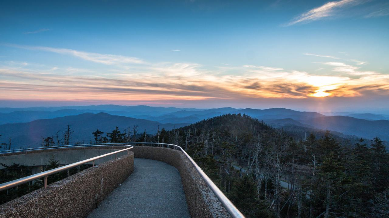 The U.S. Board on Geographic Names approved the formal name change of Clingmans Dome to Kuwohi, which means ‘mulberry place’ in Cherokee. Simon Whitehurst/Great Smoky Mountains Association
Work already underway to replace signage related to peak named after Rebel general
Katie Liming is a public information officer at Great Smoky Mountains National Park.
GATLINBURG — The U.S. Board on Geographic Names voted Sept. 18 in favor of the formal request submitted by the Eastern Band of Cherokee Indians to change the name of Clingmans Dome (FID #1326387) to Kuwohi.
Kuwohi is the Cherokee name for the mountain and translates to “mulberry place.” In Cherokee syllabary, the name is ᎫᏬᎯ. The National Park Service strongly supported the name restoration and applauds today’s decision, which also received support from local communities and governments.
Kuwohi is a sacred place for the Cherokee people and is the highest point within the traditional Cherokee homeland. Kuwohi is visible from the Qualla Boundary, the home of the Eastern Band. Efforts are already underway to update signage, website and other materials with the Kuwohi name.
Clingmans Dome has always been known as Kuwohi to the Cherokee. The mountain became known as Clingmans Dome following an 1859 survey by geographer Arnold Guyot, named for Thomas Lanier Clingman, who was a lawyer, U.S. representative and senator from North Carolina, and Confederate brigadier general.
More...
Stubborn Flint Gap fire continues to burn in Great Smokies
Written by Katie Liming That’s not the natural ‘smoke’ of the Smokies. The Flint Gap fire has burned about 50 acres south of Abrams Creek in Great Smoky Mountains National Park. National Park Service
Firefighters stage in Abrams Creek Campground in national park as more resources arrive
Katie Liming is a public affairs officer with Great Smoky Mountains National Park.
GATLINBURG — The Flint Gap Fire is 46 acres as of the last estimate. Although the fire is presently uncontained, only a few areas are actively burning within the perimeter. Once firefighter access and safety in this remote and steep terrain is addressed, a full suppression strategy will be executed.
The fire did not receive as much rain over the weekend as previously predicted; however, a local weather station did show that 0.34 inches fell on the fire early Sept. 17.
On Monday, the fire responded to decreasing relative humidities, 10 mph winds and afternoon direct sunlight with some increased activity and additional smoke. The fire is currently backing through fingers of available fuels with flame lengths of 1-3 feet in some areas. Fire activity is primarily in areas with pockets of pine litter and near drainages.
Tennessee Fish and Wildlife commission returns to Paris Landing
 Tennessee State Parks
BUCHANAN — The Tennessee Fish and Wildlife Commission will return to Paris Landing State Park for the first time in 15 years for a one-day meeting on Friday, Sept. 20. The meeting will start at 9 a.m.
A new video titled “Safe Boating Near Locks and Dams” will be presented. The video was produced by the Tennessee Wildlife Resources Agency in partnership with, Tennessee Valley Authority, U.S. Army Corps of Engineers, U.S. Coast Guard and Hardin County Emergency Management Agency.
Retired TWRA Wildlife and Forestry employee Mark Gudlin will be recognized for his induction into the National Bobwhite and Grasslands Initiative Hall of Fame. He served in a variety of roles during a 38-year TWRA career and was serving as Habitat Program Manager upon his retirement in 2021.
Will Bowling from the Rocky Mountain Elk Foundation will be recognized for a donation from the Foundation and the Mildred T. Edwards Trust. The gift will go toward purchasing a 1,322-acre tract at North Cumberland Wildlife Management Area.
There will also be a preview for rules and regulations governing licenses, permit fees and boating certificates.
Growing a Food Forest
Tuesday, Sept. 10, 2024, 5:30 p.m. at Barrelhouse by Gypsy Circus (621 Lamar Street). RSVP on Facebook
Green Drinks Knoxville will host an in-depth discussion with Dave Maasberg on how he maintains his food forest including some rare heirloom apple varieties, figs, pears, blackberries and more. He will bring samples to try and fruits for purchase to savor at home.

Raised around agriculture and the vanishing small-scale, midwestern family farm, Dave has always held a special place for fruit trees and perennial plants. After a Foraging and Wild Edible Plants class at Indiana University, his desire to create a food forest and sustainable homestead quickly turned into a reality. After over 20 years of planting and maintaining various fruiting plants on a reclaimed hillside, he is excited to share his journey with us. He currently helps others with plantings, from small scale to larger projects.
Green Drinks Knoxville is a social and professional organization that convenes open-minded folks to encourage education and conversation about the environment, green technologies, sustainable lifestyles and more.
Our events are free and open to the public. We welcome all and support racial diversity, gender equality, and LGBTQ inclusivity.
Edible Abundance Foodscapes @ Green Drinks Knoxville
Tuesday, Dec. 10, 2024, 5:30 p.m. at Albright Grove Brewing Company (2924 Sutherland Ave, Knoxville TN). RSVP on Facebook
To round out this year of great guest speakers we are thrilled to bring on Daniel Aisenbrey, the founder of Edible Abundance Foodscapes. Come hear why every landscape can and should be a foodscape!
 Get inspired by the story and experience of this great local initiative. Edible Abundance Foodscapes
For Daniel, it all started back in 2012 with a hatchback full of lumber, some borrowed tools and a passion for helping people grow food. In the decade since, Daniel has built on that passion by establishing farms and community gardens, fighting for food access in local government and even managing Knoxville’s top farmers’ market. In 2023, the culmination of that passion and experience burst from the soil as Edible Abundance Foodscapes! When he’s not building your new garden, Daniel (and partner, Beth) run Hey Moon Farm, a family farmstead for sheep, chickens, heirloom produce and two feral children. His favorite weird fruit are kiwiberries.
Green Drinks Knoxville is a social and professional organization that convenes open-minded folks to encourage education and conversation about the environment, green technologies, sustainable lifestyles and more.
Our events are free and open to the public. We welcome all and support racial diversity, gender equality and LGBTQ inclusivity.